Knowing what’s in the ground
Having a clear idea about the quantity and quality of the rock, or sand, on your site is fundamental to maximising value and reducing risk, Eltirus founder Steve Franklin writes.
For a quarry company, two things are imperative: knowing what you have in the ground and what your market is. You can have the best people, equipment and processes, but a quarry that doesn’t understand these two factors can struggle.
Why is geology important?
Some quarry deposits are simple; however, increasingly, they are not. Part of the reason for this is that many of the less complicated deposits have already been extracted, and we increasingly find sites needing to extract areas that were previously considered too difficult.
This is coupled with regulatory access to deposits; sometimes the easiest deposits are not viable to extract due to social, legal or environmental considerations, thereby potentially making the trickier deposits more viable.
The thing that probably causes most angst is variability. If you have a deposit that is consistent quality everywhere you go, then life is simple. But if you have a deposit that continually provides surprises in terms of waste quantity and quality, life gets more complicated.
This is the point where understanding your resource can be useful.
Determining what’s in the ground — drilling
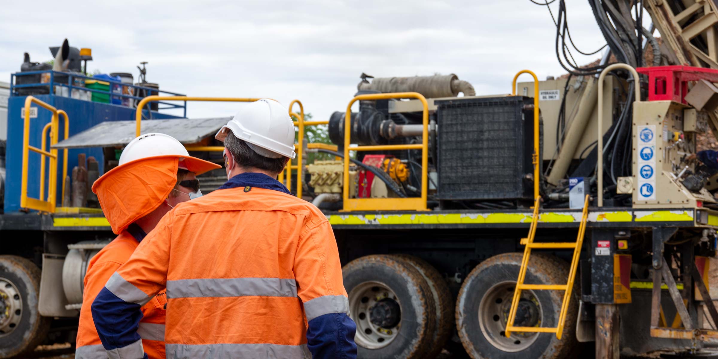
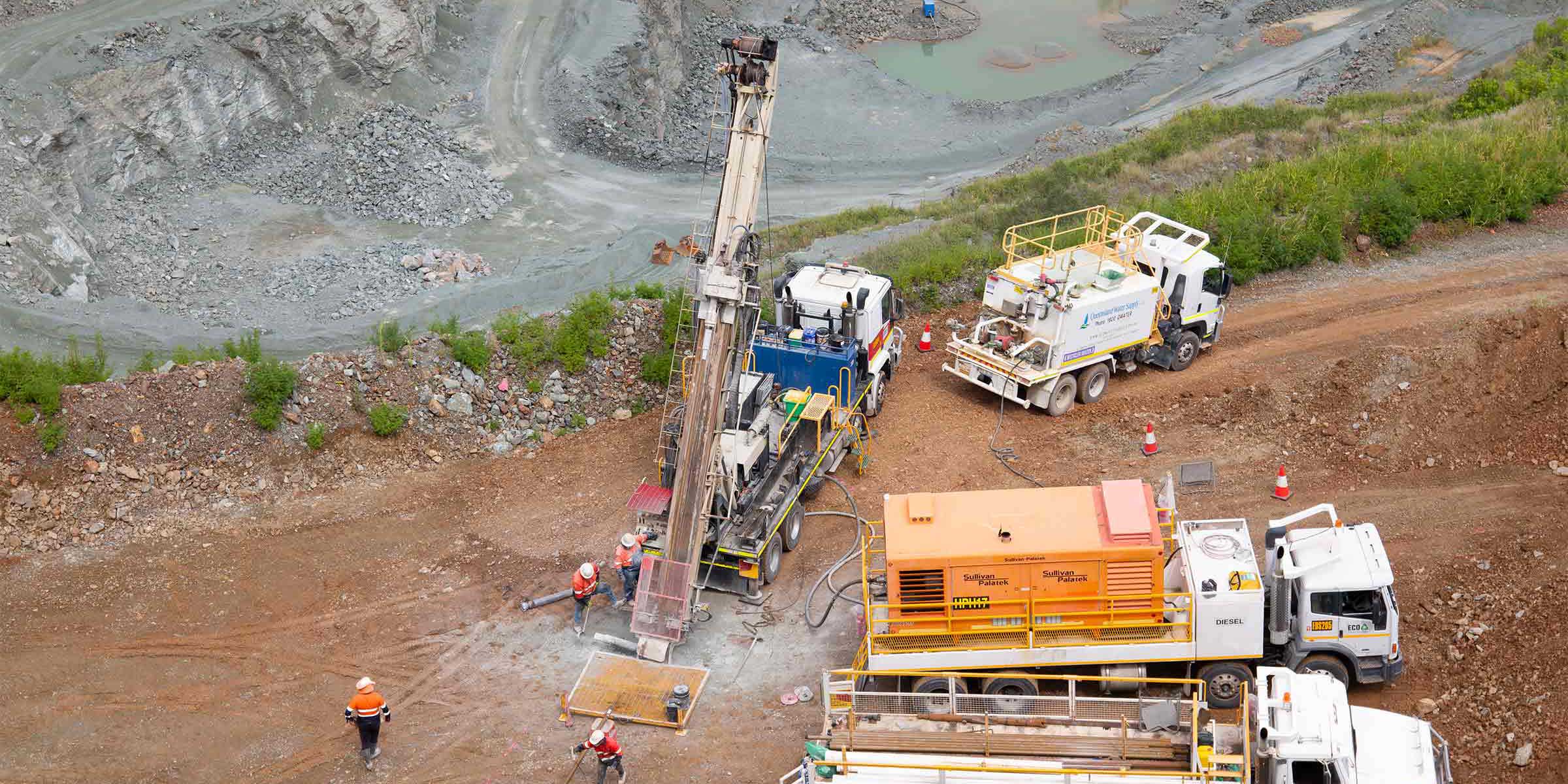
The only way you know for sure what’s in the ground is to sample it (or to extract it entirely, but by then you’ve absorbed all the risk). This can be done in many ways, from using a blast hole rig to punch some quick holes down and checking the rock chips, to using a dedicated exploration rig to drill reverse circulation (RC) or diamond core holes.
Each of these three methods has its place in any operation, but there is no going past a good, detailed diamond core program (coupled with RC holes to fill in the detail) to give a good sense of the overburden thickness, the quality and material properties of the rock, and geotechnical characteristics.
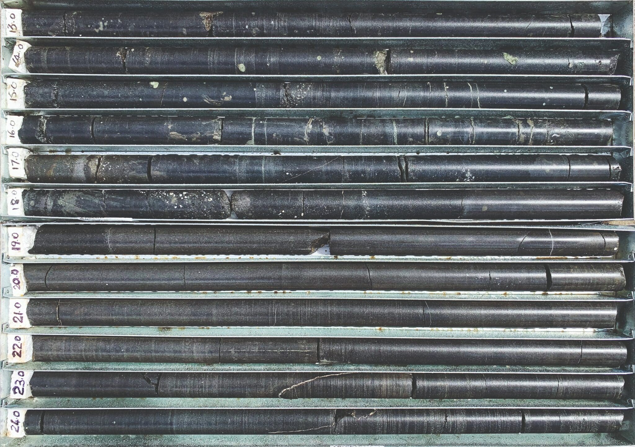
Diamond core drilling is considered the best way to get a sense of what is in the ground.
Blast rig holes
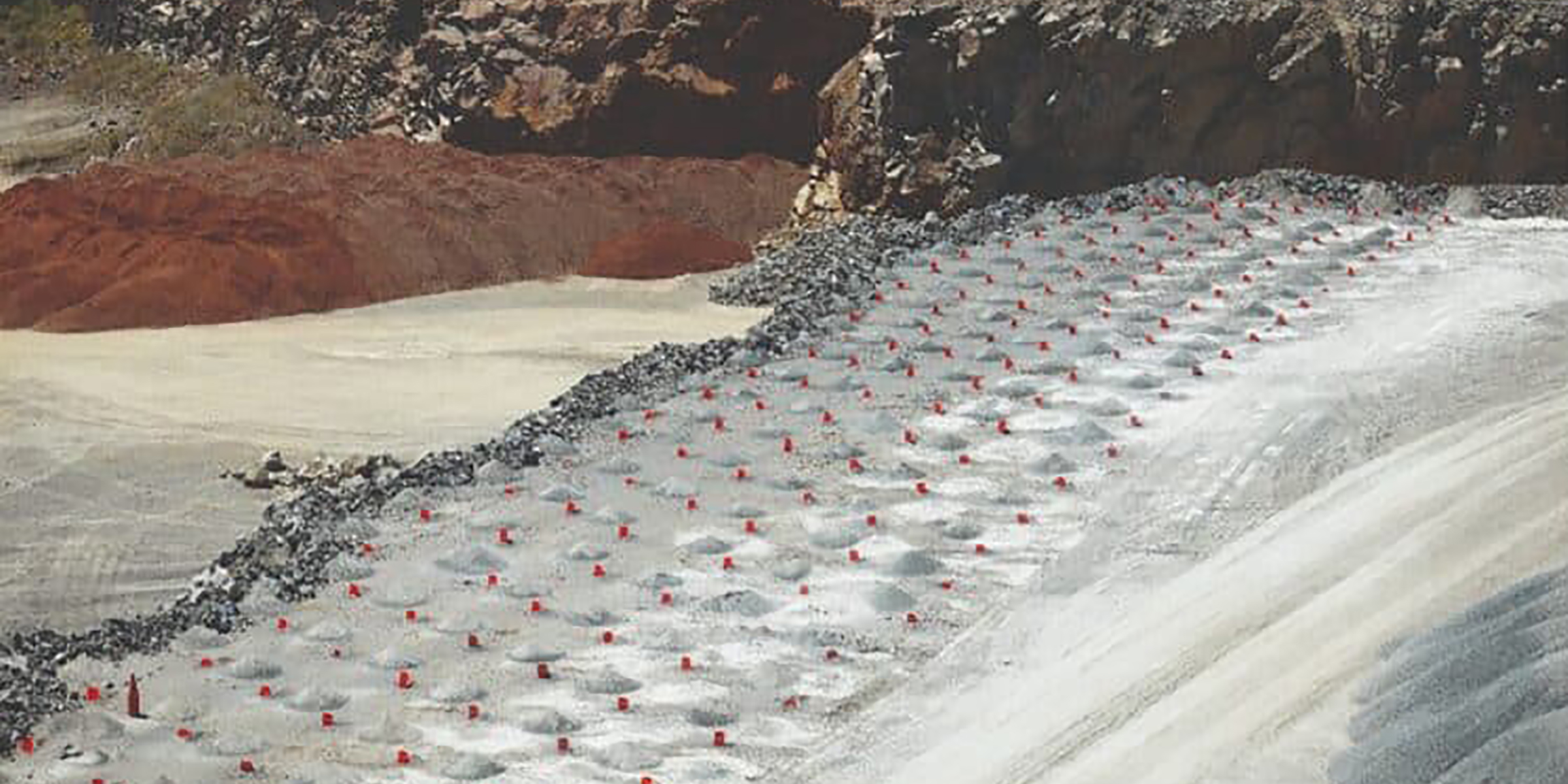
A blast rig is a useful tool to help mitigate short-term risk and understand what is immediately in front of you (ie the next bench down).The primary limitation, however, is that it can only drill approximately 25m deep and the cuttings are blown up the inside the hole, potentially causing contamination of the sample.
Additionally, the blast rig tends to produce very fine chips and lots of dust, so it can be challenging to get a real sense of the material quality. Lastly, it is not customary for blast hole rigs to have people working in close proximity to collect samples, making safety a key consideration.
RC holes
This type of drilling is called ‘reverse circulation’ because it has a path through the drill pipe (it has two walls inside) for the air to go to the bottom of the hole and one for the cuttings to return to the surface, eliminating sample contamination. RC drill rigs are set up for sampling and can drill much deeper than a blast hole rig.
Like the blast hole rig, however, the rock is pulverised, and it can be difficult to interpret the rock type and properties. There is also limited test work that can be undertaken on rock chips obtained from RC drilling.
Diamond core holes
This is ultimately the best way to get a sense of what is in the ground. As the name suggests, using a diamond-impregnated drill bit with a hollow drill pipe, a core of rock can be obtained as a sample. If the orientation is recorded, the core can also help a geotechnical engineer better understand the faults and fractures in the rock and provide advice on how best to design the pit.
Diamond core gives a geologist by far the best understanding of what is under the surface and provides samples large enough for more comprehensive testing.
Geological modelling
We see a lot of historical drilling program data in the course of our work. A few things often stand out.
Firstly, the collar positions of the drill holes were either not surveyed or, at best, picked up with a handheld GPS device. Of most importance is the collar RL (reduced level), and this is routinely the position with the least accuracy.
Secondly, we see situations where the holes were not logged. As in, a geologist didn’t take the time to review the samples, categorise the materials and create a visual, down-the-hole record of the drill hole. Logging is vital and can be created on the fly using tablet-based solutions and augmented with visual logs of each sample interval and key results once the geologist is back in the office.
Thirdly, even where samples have been taken, the test results are not recorded or not assigned to the drilling records. Experience has shown that the use of company-wide systems to record the validated location, log data, sample results and visual data of all holes is an invaluable asset that can then be built on over time and improved as new information comes to hand.
Lastly, holes may have been surveyed and logged, but the results were not then used to create or update a 3D geological model. It is not uncommon to find cross-sections in reports without any actual model that can be interrogated to better understand the data.
With all the above, it can be immensely valuable to have data recorded digitally. Paper or PDF logs are great but are of limited use when collating into a computer-based 3D model without needing to laboriously digitise the data.
Geological cross-sections and wire-frame models are also great for stakeholder engagement but are of little use when undertaking downstream studies such as pit design, scheduling or resource optimisation. Regardless of who does core logging or geological modelling, always insist on a digital copy of log data, as well as industry format copies of the resultant geological model.
Inventory the deposit
Once you have an accurate geological model, you can move on to getting a better understanding of how much of each material type can be extracted.
People will often talk of resource and reserve tonnes, using the terms interchangeably; this is not correct and it’s worth clarifying what they mean.
In short, resource tonnes give a sense of which portions of a deposit might economically and legally be extractable. For example, within the extraction boundary and constrained by a feasible (legal and safe) maximum pit design, the quarry may have 10 million tonnes of basalt resource available.
When discussing reserve tonnes, we are talking about material the site has a feasible plan to economically extract. As in, an appropriate mining methodology has been identified, the resource has been scheduled, and quality considerations have been considered to allow for mining and processing losses.
Reserves are always a sub-set of resource and are modified by factors like those mentioned above. Using the same example, a quarry may have 10 million tonnes of basalt, but operational considerations (eg haul roads, ramps, catch benches) within the maximum pit may reduce the reserves. Furthermore, not all 10 million tonnes of basalt may be saleable as the primary quarry product, with further losses during processing.
Thus, the reserves may be five million tonnes premium aggregate and four million tonnes road base products, for a total reserve of nine million tonnes (and one million tonnes held up in operational ramps/roads or lost during processing). It should also be noted that for resource to be converted to reserves, a known market must exist (ie it must be saleable).
To determine the resource, a viable pit design that enables economical extraction to take place is needed. Determining a viable design is not always as simple as it sounds because it is a function of the material, its sale value, and extraction cost.
At this point, we’re crossing into economic geology and the application of software tools to determine a net present value (NPV) optimised design and the right sized stages to extract it.
Once we have this, we can then apply it against our geological model to help understand not only how many tonnes of material we have in total, but also the quantity of each of the different types of material in the geological model.
To calculate reserves, the resource needs to be appropriately scheduled considering extraction methodology, material quality and processing, and market considerations.
Unpacking the deposit
Have you ever been asked how much stripping needs to be done this year or whether you can produce enough asphalt aggregate to satisfy a large project, only to be unsure as to the answer?
The solution is a scheduling model.
A scheduling model allows you to understand how to “unpack” a deposit – what needs to be moved and when. With a sound geological model and an optimised pit design, scheduling models allow you to play “what if?” to answer the sort of questions noted above.
Making the most of technology
Technology is changing many facets of quarrying, and geology is one of them. We can put a geologist in the field with a 2cm-accurate GPS survey device to lay out and log the position of holes, who can then digitally log the samples as they come off the exploration rig in real-time, in a standardised way and without the need to transcribe paper to computer.
The logging system can help the project manager understand what has been drilled and where each day, and act as a central database of all test results and their status at the lab. This same database can then provide the information that a resource geologist needs to create or update the model they are working on.
New-generation software allows these models to be kept up-to-date relatively easily. Drilling results and models can then be fed to any stakeholder that needs it through a web-based platform.
Finally, the creation of a good computer-based geological model forms the foundation for further risk-reducing studies such as resource optimisation and scheduling. New-generation software tools have fast and efficient algorithms allowing for rapid scenario testing to really explore how best to add value to your operations.
Simply put, it all starts with understanding your resource. An investment in geology, done well, is an investment in the future of your quarry, one that will pay significant dividends in helping you make better plans, reduce unexpected surprises, and maximise the value of your deposit.
This article was originally published in Quarry Magazine – click here to view original article.
To find out more, contact Steve Franklin on +61 474 183 939 or [email protected]


